These are usually short circular walks, the photos are all in order of the route left to right (although they may not have been taken on the day of the walk). If you click on a photo you will be taken to a larger image on my flickr page, where you can also click on, map, on the left of the page to find the location.

Thursday 4 July 2019

Beach Walk, Tenby Wales

On our last trip to Wales, we did a beach walk of about 3.5 miles or 5.6 kilometers.

We set off from the South Beach Bar & Grill, right at the end of the town, but wandered inland until we reached the rail line then heated away from town following the line.

Tenby Beach, Wales

The golf club was on the left, between us and the beach, the campsite was on the right. We continued along this way to the bridge over the railway, were I stopped to take photos of the train.

Train

After I got my photo we continued following the line, until we came to a level crossing were we had to cross over and head even further inland. At the main road we turned left and walked into town, Penally were we crossed back over the railway at the train station.

Penally, Station

We were now heading back towards the sea but first we passed a rifle range, Penally Training Camp is close by, so I assume it wes theirs.

Gun Range

From the rifle range it was left again and uphill towards the sea. There were some fantastic views from up there, to the left, to the right and out to sea.

Caldey Island & St Margaret's Island

That one was straight out to sea, the two below are looking right and then left, the way we were off next, to get back.

Penally Cliffs Long View Of Tenby

It was a little bit of a struggle to get down to the beach but we got there. then it was astright walk back to where we started.

Dot Plodging

Sunday 30 June 2019

Bath, from the Campsite to the Center

When we were in Bath last year we walked along the river Avon from the Campsite, Bath Marina & Caravan Park, to the famous Pulteney Bridge, taking photos of the many bridges as we went.

The walk is about 3.0 miles or 4.8 km, we set off into bath center, by walking along the river, only we could not get to the river until we had walked for quite some time. Anyway we got there and it was quite a long walk. I think there was another way out of the campsite that went straight onto the river but we missed it.

Out the site we went right onto Brassmill lane, to get onto the river side but the road just took a long time to get there, about half a mile. In fact we joined at Weston Cut a short canal near the lock gates.

Lock Bridge on the Avon

From there we passed many bridges over the river Avon and I took photos of then all, so here are a couple of them along the way.

Victoria Bridge Midland Bridge

After about a mile or so we came to the center but instead of going away from the river we decided to carry on until we came to Pulteney Bridge, the famous one for Bath. First at the Train Station we crossed over the river and continued on the other side.

Old Railway Bridge

Its an quite an easy walk following a river, so we continued our walk until we came to the Pulteney Bridge and the weirs.

Walking towards Pulteney Bridge

Once across the bride that was the end of our walk, we were pretty tired after the walk, so went for drinks and as for getting back, we caught a bus.

Walk, Auxerre, France

Walk, Auxerre centre from the municipal campsite, France, Approximately 6.7 mile or 10.8 kilometres.

This route to town is a lot more pleasant than the shorter route.

Out of the campsite entrance, we crossed over the road, turned left and walk along Quai de la République. Take the first right turn at the traffic lights, then down by the side of the stadium, here we came to the river and swimming pool complex. At the river Yonne, we turned left again and follow the riverside path. At the lock we took the small footbridge and continued along the river bank.

Cathédrale Saint-Étienne, France 2003

It may be slightly longer this way but it's much more enjoyable, with magnificent views of the churches and bridges.  At the first bridge the Pont Paul Bert, we continued on underneath, toward the next bridge.

River Yonne looking towards the city, France 2003

We did walk past the main road up in to the centre, as we where taking in the river passed the Cathédrale Saint-Étienneand and the footbridge over the river.

Auxerre, France 2003

Than at the Abbaye Saint-Germain we eventually headed into the centre. At the end of the riverside car park after the footbridge, we crossed over the road and into Place du Coche d'Eau. Then headed up the hill away from the Abbey back towards the Cathedral.

Abbaye Saint-Germain d'Auxerre, France 2005

By that time we were very hot and thirsty, so when we did come to a smell bar we popped in for a drink and sat outside. After a while the barman comes out and asks if we are parked along this road, as the traffic warden is on the way, I think this is very thoughtful of him. So as a thank you I order more beer.

Clock, Auxerre, France 2005.

After a wander around the center we walked back via the main road, the Route de Vaux, a long straight boring route or you can go back down to the river and walk back the way you came, it is much better and you can get a beer at the swimming pool, as you pass.

Leffe Auxerre France 2003

Sunday 2 December 2018

Walk, Ingleton Waterfall Trail

Today we are walking the Ingleton Waterfall Trail, it would have been wrong to come here and not do it. So we drove back into the village and to the start of the waterfall walk. We got parked up and payed the entrance fee, then set of on the long walk along one river then across, to come back along another river.

The walk is 4.3 mile or 7 km, and is up and down hills along the way, so we were well dressed for it, it was slightly wet as well. The girls had the activity pack and had to take rubbings along the way. We set off along the river Twiss, it was more up and down that I thought it would be.

Out for a walk Dot and the girls

As we walked along, up the river the waterfalls seemed to be getting bigger.

Falls Falls

And bigger.

Waterfall Waterfall 1

After the last big waterfall we came out of the trees and crossed the river a couple of times then headed up onto the moors.

Footbridge Footbridge

As it was uphill the younger ones went off in front and me and Dot made our way up after them as best as we could. We could see them up ahead next to an ice cream van, how on earth an ice cream van got there I do not know.

Ice Cream

We walked back down the hill towards the other river running down into Ingleton but stopped at the cafe half way in the walk for tea and sandwiches. From there we could see the entrance to White Scar Cave and all the car parking for it.

White Scar Cave A rest half way

The walk back down to Ingleton along the river Doe was just as good as the walk the other way.

Waterfalls Falls

The girls were still doing their the activity packs but all too soon we were back at the start.

Georgia and Emily Walking

Tuesday 27 June 2017

Walk, Nene Valley Railway


Dot and I decided to pass the time with a walk and we though I would be good to follow the path of the Nene Valley Railway.

We turned right left out of the campsite and headed towards the Ferry Meadows Train Station. At the level crossing we turned right and followed the path that runs alongside the line. It is rather a long straight path and for the first part the campsite is on the right. Just after a road bridge over the railway, the path veers away from the line for a short stretch but if you keep left you soon get back to it.

Graffiti

Next the footpath crosses over to the other side of the line at a small level crossing and then we crossed over the river Nean via a footbridge attached to the rail bridge

Railway over the river Nene

We continued on this side to the next road bridge and the about half a mile further but then turned back as we had gone far enough for today and we had to meet Ralph for a lift to the party.


We went back the way we came but when we got back to the part of the path veers away from the line, we followed the road that led to the Lakeside Cafe, as we were walking Ralph phoned and agreed to meet us there. We all had a beer there before setting off to see Amber.

Thursday 15 December 2016

Walk, Cotherstone Village, Teessdale

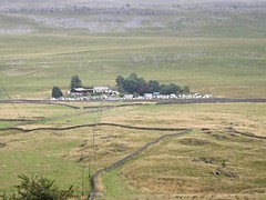
Walk, Cotherstone, Approximately 3.0 mile or 4.8 kilometres

Dot and I had already done part of this walk before but today's was much longer. We had our picnic and waterproofs, so off we went.

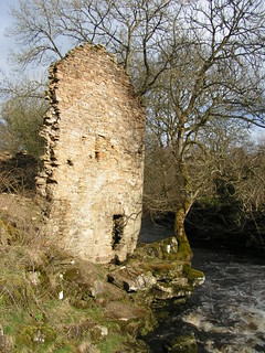
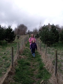
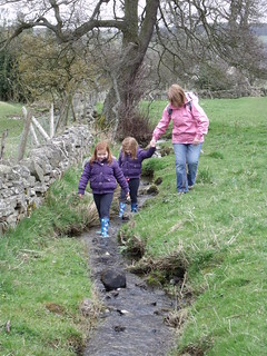
We set off out of the side gate and down the steep dirt path from the site in the direction of the village, not a good path but safer than the road. We walked alongside the river Balder, passed the remains the old watermill and then, crossed over the field to the road.


Across the field at the road, we crossed the river and then over to the left of the the road to the public right of way.

Cotherstone Bridge

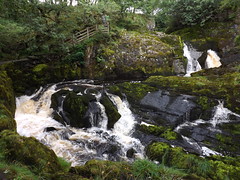
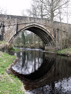
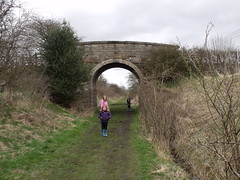
We then turned left along the public right of way just over the bridge and headed towards the river Tees, this path is fairly slippery but not too bad, until it veers away from the river, around a house.

Pipe Bridge

This part of the path was nearly impassable with beep mud the first time we did this walk but we managed to get through (this has now been resurfaced but beware), the rest of the way down to the confluence with the river Tees, is along a narrow road set back from the river Balder.

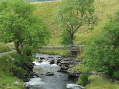
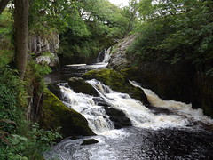
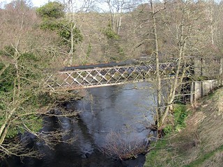
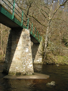
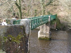
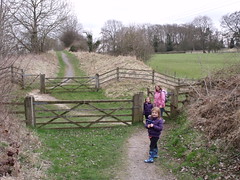
At the confluence where there are footbridges over both rivers, we crossed over the Balder via a footbridge, then the other footbridge over the Tees.

Footbridge over the Tees

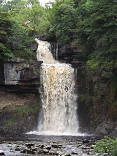
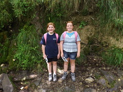
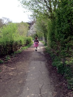
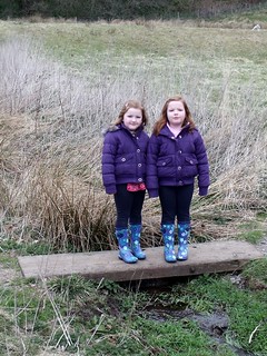
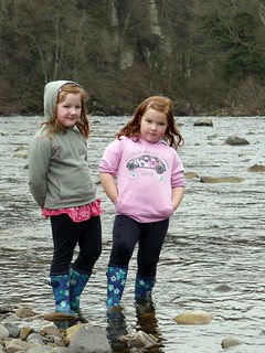
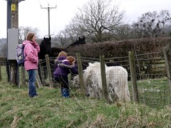
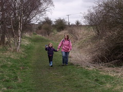
We then headed east along the river banks, where the girls played in the river for a while.  They had hoped to play on the rope swing that they had played on last time they were there, but the rope had gone.


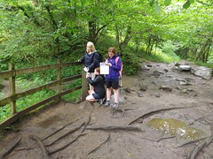
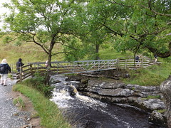
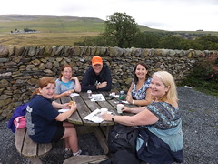
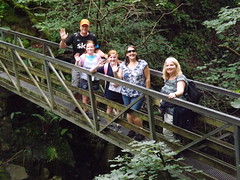
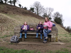
Then we crossed back over the two bridges, for our picnic lunch, on a nice seat overlooking the confluence ot two rivers.  The girls also played in the river again under the bridge over the Balder


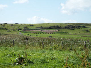
After lunch we set off up the hill behind the seat (you can see it in the photo above), Dot and I had walked this way before. It is steep but not too long and you get a very good view along the Tees from the top.

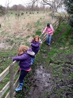
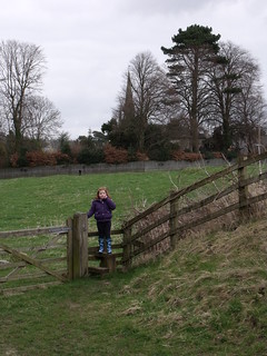
At the top we came to a road and some houses but instead of walking back into town along the road we followed the public footpath across the field. All was well until we came to a dip that was full of mud, we had to climb along the fence to get passed.


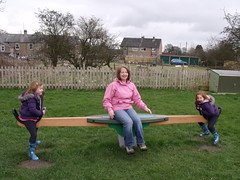
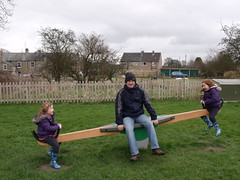
The path comes out on t he main road, where we turned left and headed for the green.   From there we walked along the Bowes road towards the village hall (I was heading for the old railway line).   Anyway we came to a path on the left that led to a playground, there was no getting out of spending an hour there.  Good job I was carrying a book with me.


We came back out from the park the way we went in and took the path opposite which led to the Tees Railway Path, which in turn leads back passed the campsite.


There is an easier way to the walk by just continuing along the Bowes road until is crosses the path of the old railway though.


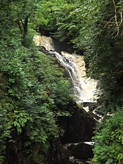
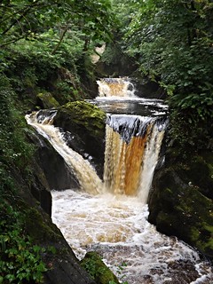
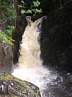
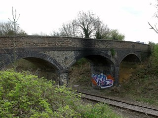
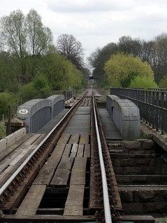
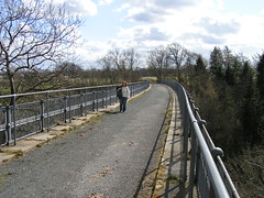
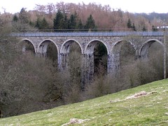
The path is level and easy to walk and stayed on the railway path until just after the fantastic viaduct over the river Balder.


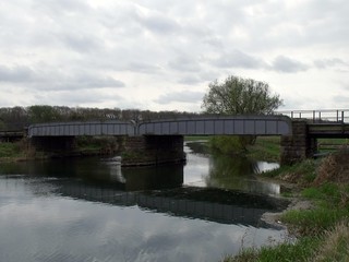
Just over the river another public footpath crossed Tees Valley Railway Path and a turn to the right took us back to the campsite, the way we had walked on the previous day.